This railroad was originally constructed in 1883 starting in Jersey Shore, PA as an agreement with the Clearfield Bituminous Coal Company to construct mines for bituminous coal plus clay and coke ovens with this railroad as the means to transport the material. The railroad line ran through several towns including Monument, Orviston, Snow Shoe, and Peale to name a few. A tunnel was constructed in Peale which is 1,277 feet long and was a major accomplishment for the railroad. Later a viaduct was constructed in 1884 and later rebuilt in 1902. It is 770 feet long and 110 feet high. Once completed, the railroad was extended to as far as Mahaffey Junction. The railroad became the "Beech Creek Railroad Company" in 1886 but was then leased by the New York Central starting in 1890. Ten years later, it was absorbed into the New York Central and was known as the "Beech Creek District of the Pennsylvania Division" In 1968 the New York Central merged with the Pennsylvania Railroad to form "Penn Central" The line was partially abandoned from Snow Shoe to Mill Hall in 1966. The remaining section was absorbed into Conrail in 1976 and the line saw operations until 1993 when the remaining section was abandoned. In 1994 Headwaters Charitable Trust acquired the right-of-way from Conrail with the plans to develop a rails to trails project. Today a 19 mile section of this former railroad line is "Snow Shoe Rails to Trails" which is a multi-use motorized and non-motorized recreational trail. Since the line was partially abandoned in 1966-68, the mile points also changed in some locations. References to mile points along the line will be the historic original points and not the Conrail numbering.
The pictures on this page were taken at different times, and different years. Some pictures are only drive-by photos as most of the 1966 abandonment is inaccessible. I will try to piece together the pictures from lowest mile points (from Jersey Shore) upwards. The lower mile points are only estimates until I can locate a real mile post to adjust my projected points.
The pictures presented start in the town of Beech Creek and are only spot pictures where the railbed was viewable from roadside pictures. More detailed pictures are in the now Snow Shoe Rails to Trails section. Coverage of the line ends at Coledale where the remaining line is inaccessible and some parts from Wallacetown to Clearfield are still in use today.
Snow Shoe Rails to Trails website:
http://www.ssrt.org
Beech Creek to Orviston
These pictures are all drive-by. Turning off Route 150 at Beech Creek on to Route 364 also known as "Monument-Orviston Rd", this road follows the railbed and the railbed can be seen at times close to the road. Being a narrow road, pulling to the side for pictures is difficult.


Orviston to Panther
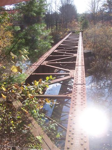
Recently an ATV connection trail was created to connect the Snow Shoe Rails to Trails to the Bloody Skillet State Forest trail system. Along this connecting trail, it utilizes a small portion of the railroad bed and a new bridge was constructed where the old railroad bridge once was and was removed after the line was abandoned. It is only a small section but between Orviston and Clarence, there were a total of 15 bridges, some are still in place, others like the one shown, was removed. The original abutments that hold this new bridge are still in place and it was nice to see DCNR did not replace them.


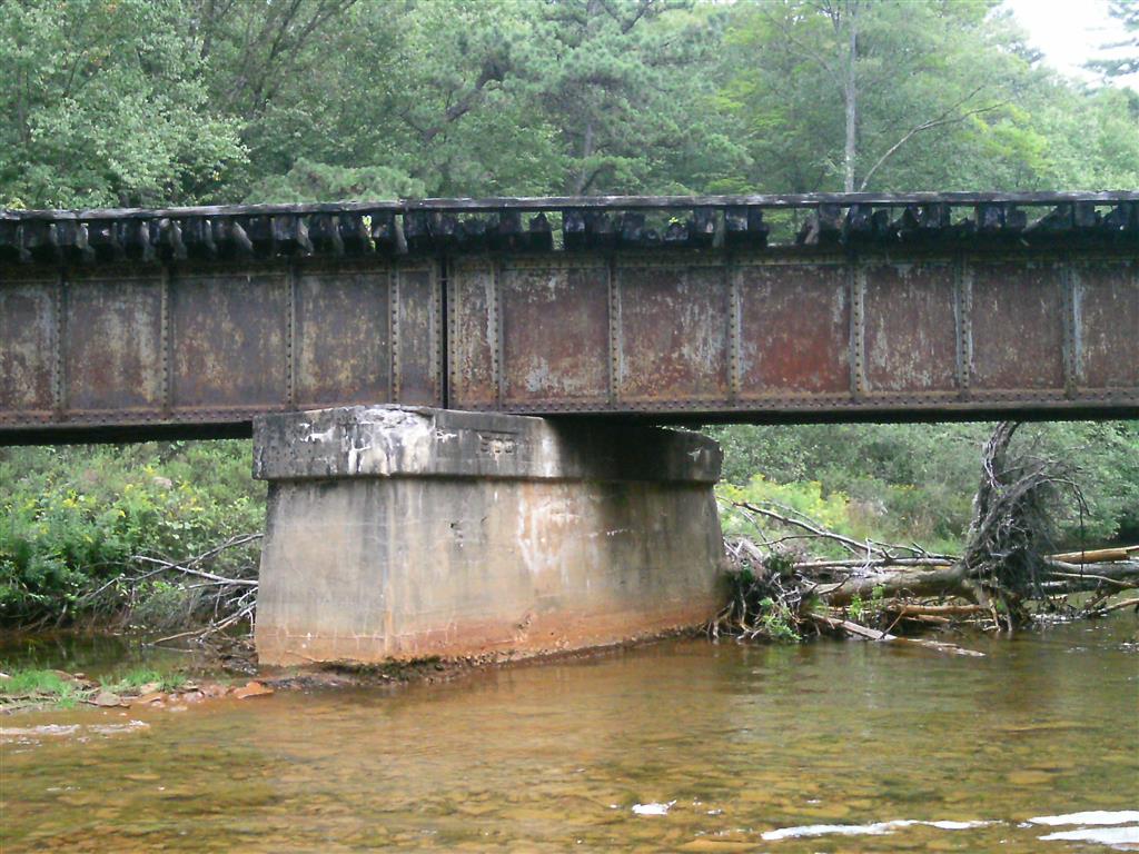
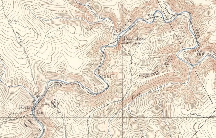
Panther area
From Orviston to Panther the railroad crosses over Beech Creek 15 times according to the maps I have. There is also a tunnel with a curve in it still standing to this day. We only saw a small section of this railbed since sections of it are totally grown in and some of the bridges are now missing. The pictures seen here are taken around the tunnel area.

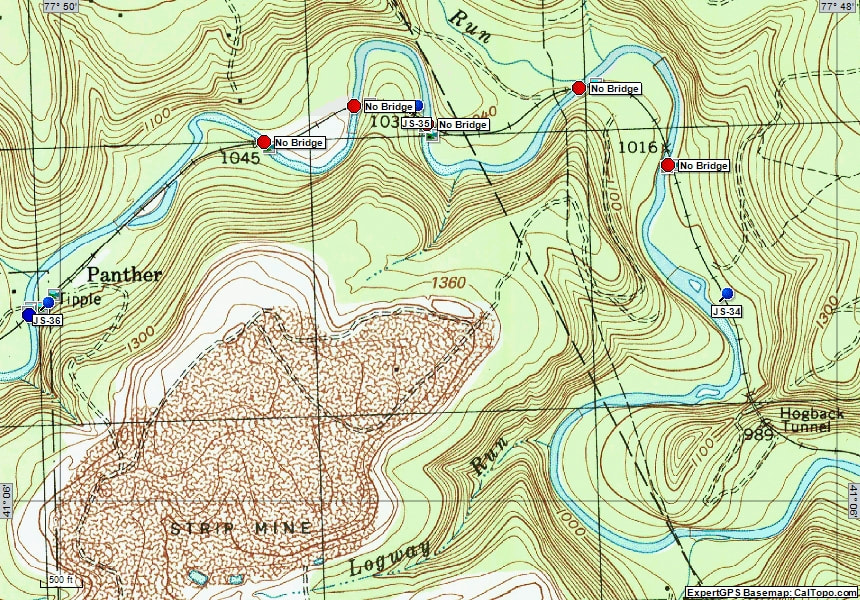
This is a 7.5K Topographical map of the area.


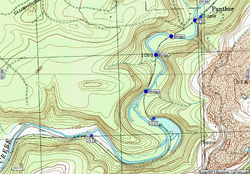
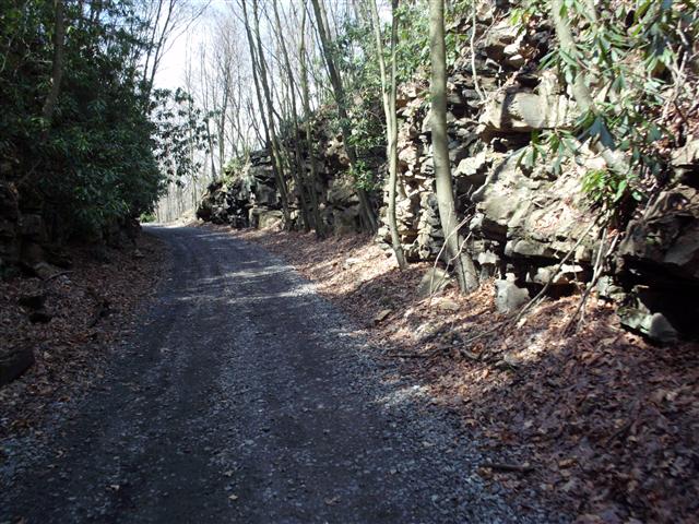
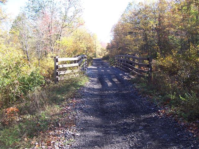
Panther to Kato
From the Hogback tunnel to Kato there are nine bridges that cross Beech Creek. The first five bridges are missing and the other four are still in place.


Maps of area explored
Historical map from 1923
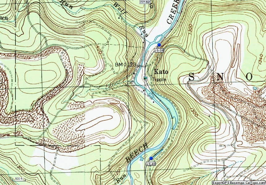
Kato
This section the township roads are legal to ride. It crosses over a single lane bridge next to a tipple that once was here. As this historical map shows, a small track that served the tipple was here crossing the Beech Creek Railroad at a 90 degree angle. This area needs more exploring done when the growth is down. These pictures were also taken at different times and years. The road bridge was not that track but perhaps remains of the abutments can be found to show the exact alignment of this small track.


Clarence
At the intersection of Clarence Road is where Snow Shoe Rails to Trails begins. The township roads to Kato and the connection to Bloody Skillet is also legal to ATV use. At the time these pictures were taken, the road was closed due to replacement of a bridge. This map below is from 1931 and shows this section. The PRR railroad also operated several branch lines in this area as seen on the map.


Gillintown
The next section as shown on this historic map includes the large trail head parking area in Gillinton. The parking area was last used by R. S. Carlin, Inc. as a coal tipple. There are no remains of that today. This is the main trail head parking for SSRT. The Pennsylvania Railroad's Snow Shoe branch also crosses over the Beech Creek line near Route 144.


Gorton
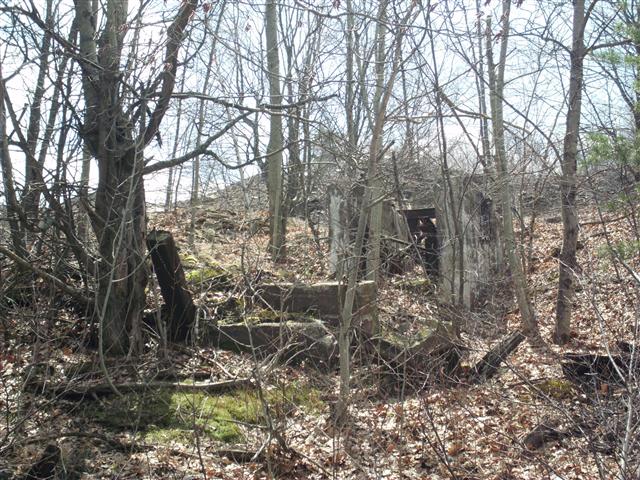
This section covers the town of Gorton. In this area there was staging tracks and fire clay was mined in this area. Some remains of the coke ovens were seen. The station at Gorton is now gone. There was also nearby the remains of the Tunnel mine #5 railbed. The second map is more modern with some notes of historical items although not all were found. It does show the staging tracks at Gorton but remains of this are erased.


Peale
The next section is Peale. The highlight of this section is the Peale Tunnel. Constructed in 1883 it is 1,277 feet long and is still in use today as part of the Snow Shoe Rails to Trails. There are other remains in this section including the remains of a section gang bunkhouse, later used as a hunting camp until it burned down. The map below is from 1931 showing the tunnel and the mile posts. The Peale train station is also in this location but was not found. Hopefully a trip in the future we can find the actual train station remains.


Viaduct
This next section has a large viaduct over Moshannon Creek. The town here is actually named "Viaduct" This large bridge was originally constructed in 1884. It is 770 feet long and 110 feet above the creek. In 1903, the iron spans were replaced with steel. Some of the original pedestals are still in place. The viaduct is still in good condition to this day. After the viaduct the mainline turns East, then south to follow the creek. The other track seen was the Grassflat branch which also served other mines. This formed a "wye" after the south side of the viaduct. There were structures here at one time, but there is no remains today. This section will cover from the viaduct to the end of the SSRT trail. The Grassflat branch section is at the bottom of this page.


Winburne
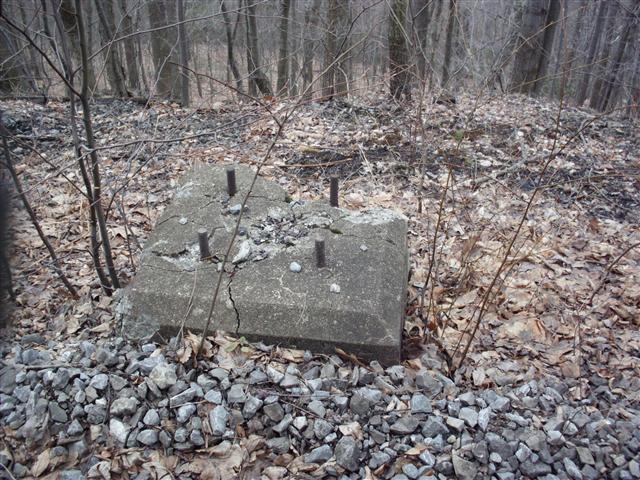
This section covers Winburne. As the map shows where the creek does a sharp curve there was a spur track that once serviced kilns. A few other interesting things were found here including some unusual tie plates, and a mile post still intact.


Munson
The next town is Munson. Another set of tracks diverged off the main line right at the road crossing, but no signs of it were seen. At times the path diverges away from the railbed. At the "wye" shown on the map at Casanova, the main line heads west. We were following the Philipsburg branch past mile point 67.4. This explains why the ties in place were gone.


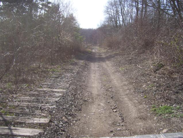


Coaldale
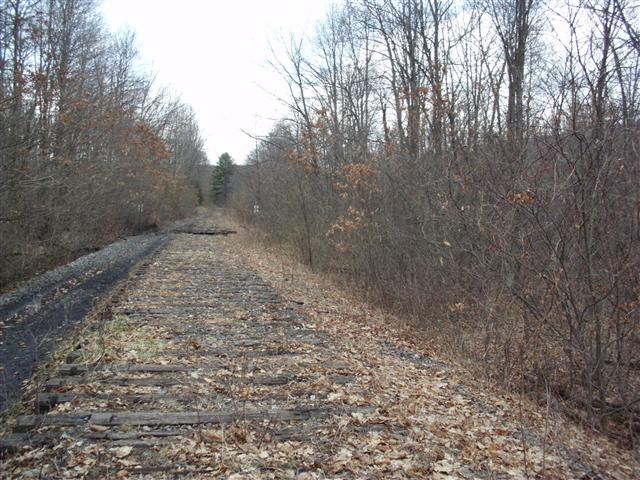
The last part I have pictures of shows only railbed and no ties. The area that the ties were pulled out covers a few miles and beyond where I photographed. Originally I thought we were following the Beech Creek main line but after further research it was discovered this is the Philipsburg branch which explains why the railbed changed from having the ties in place to where the ties were removed. The junction was above at Casanova.


Grassflat
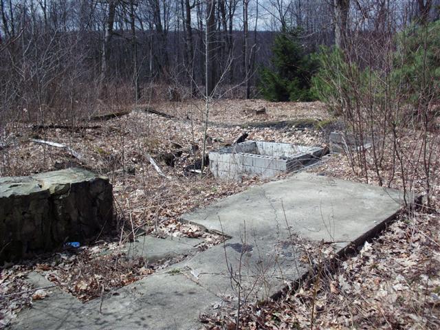
This was a branch line just after the viaduct that also serviced several mines. The branch which was almost ten miles in length, served coal tipples at Knox Run, Grassflat Mines (or Cooper No. 1), Pleasant Hill, Moravian and Cooper No. 2. All of these mines were originally operated by the Clearfield Bituminous Coal Corporation. Historical documents don't tell when this branch line was abandoned but from looking at it I would guess around 1960. Since this is a branch line, there are no mile points to reference. Parts of the spur tracks that come off this branch line are on private property and inaccessible. Other sections are heavily grown in and recently there has been some apparent logging activity which has disrupted the area.


SPV Map of the Railroad
This map is taken from the Steam Powered Video railroad Atlas. I colorized in the sections of interest to show the main line and the several branch lines that I showed above. The only part not shown in the pictures above is "DeHass Road" which is now an access road for the Bloody Skillet ATV state trail system. At one time this was a spur line that serviced a mine in Orviston. The PRR's Sugar Camp branch and Snow Shoe branch are also shown.
